Accessible ‘Tactile Walking Surface Indicators’ Pilot Project Underway to Help People with Disabilities Navigate the City
 SDOT Director Greg Spotts learns about the experiences of people with vision disabilities while using the white cane of Marci Carpenter, President of the Seattle Chapter of the National Federation of the Blind, during a field visit last fall. Photo: SDOT
Blog stats: 1,500 words | 7-minute read
At-a-glance:
- We’re piloting several ‘Tactile Walking Surface Indicator’ treatments to help people with vision disabilities travel in Seattle with greater predictability and comfort.
- Our pilot project focuses on a new type of treatment – a trapezoid-shaped ‘Tactile Warning Delineator’ that will create a rollable edge treatment to support non-visual, tactile navigation for people with vision disabilities.
- As we deploy these treatments in Seattle this summer, we’ll observe how they’re performing and conduct real-world testing with people with disabilities, in partnership with several local disabilities-focused organizations.
- We plan to test and collect feedback in late summer 2024, with the first pilot location in the University District. Click here to see photos of the new tactile elements we’ve installed in the U District.
- If you have any questions, you can reach our Americans with Disabilities Act (ADA) Program team at DOT_ADAProgram@seattle.gov or visit our website.
- We also fund the Outdoors for All adaptive cycling program for people of all ages and abilities to enjoy biking in Seattle. Learn more about the program on our blog and consider participating this summer.
We’re committed to making Seattle more accessible, welcoming, and comfortable for all people, including people with disabilities. In support of this work, we’re continuing to pilot new and emerging tactile treatments. This includes specialized Tactile Walking Surface Indicators to support people who are blind, DeafBlind, or have low vision, particularly folks who use white canes to navigate the city. We’re excited to launch this pilot effort, building off existing tactile treatments, and introducing a new treatment detailed in this blog post.
Definition: Tactile Walking Surface Indicator
Tactile Walking Surface Indicator is a term used to describe physical treatments that support non-visual navigation and provide wayfinding, edge treatments, and hazard cues for people with vision disabilities.
Purpose of the pilot project:
- Introduce a new type of treatment to our accessible wayfinding toolbox, known as a Tactile Warning Delineator, a trapezoid-shaped pedestrian surface treatment that acts as a cane-detectable edge.
- Focus the pilot on this new treatment in a site-specific context where a mix of travel modes exists, including parallel and/or perpendicular crossing movements.
- Incorporate combinations of treatments together to gather feedback on detectability and how different people experience the treatments, including people with mobility disabilities, cyclists, and shared mobility users who may encounter these elements next to bike facilities.
- Determine best practices for application details, such as different colors and contrast with the surrounding materials, transitions between different types of treatments, as well as other operational and/or environmental considerations such as breaks in the treatment for drainage purposes.
- Develop new standards and best practices for consistent application of these treatments around Seattle.
We expect the types of treatments we’re installing to help people who are blind, DeafBlind, or with low vision more predictably navigate our streets and get where they need to go. For example, when bike facilities and pedestrian paths are next to each other, these treatments can help define where one path starts and the other ends. When these paths are located near transit stops (like a bus station, light rail station, or the streetcar), the treatments can help people navigate the area without coming into conflict with other modes of travel.
Here are the three types of treatments we plan to install and test this summer.
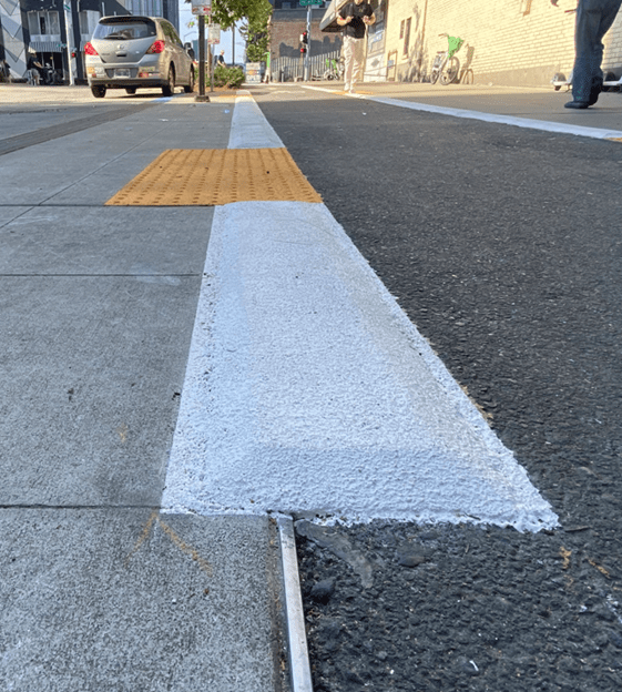
1) Tactile Warning Delineator – a raised, linear trapezoid surface edge treatment
2) Detectable Warning Surface – truncated domes

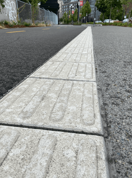
3) Tactile Directional Indicator – a set of 2 to 4 raised, truncated parallel bars
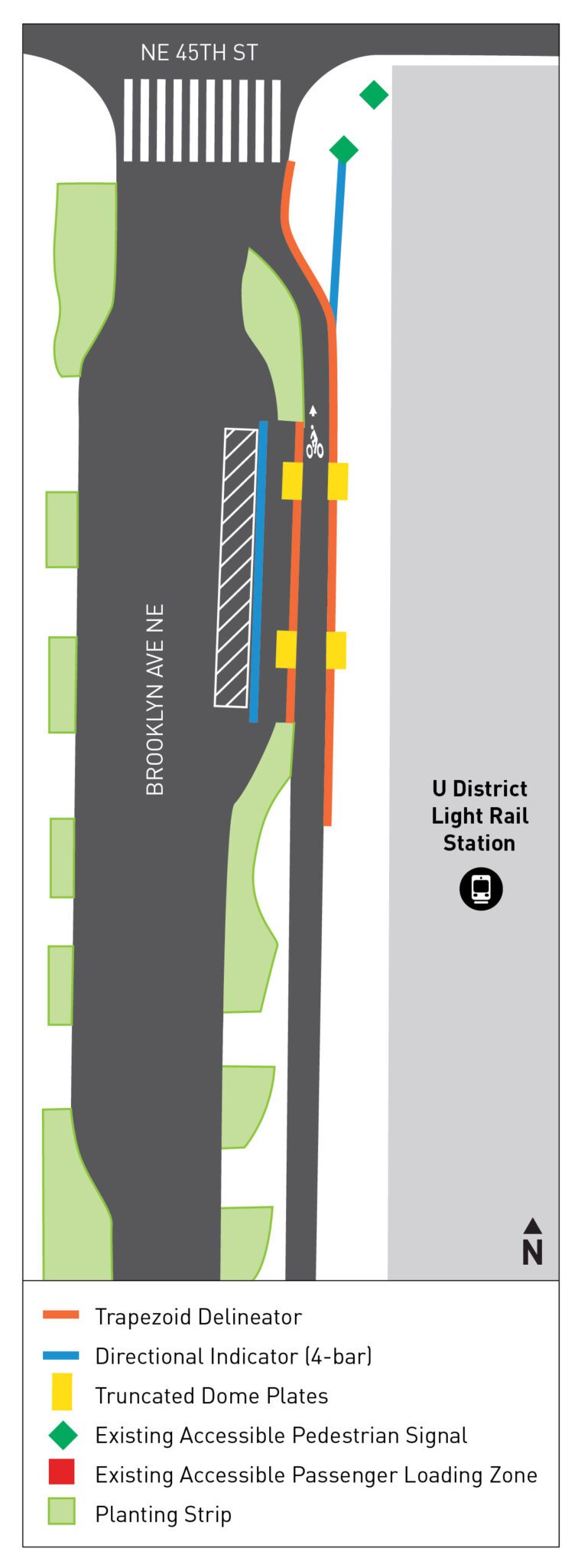
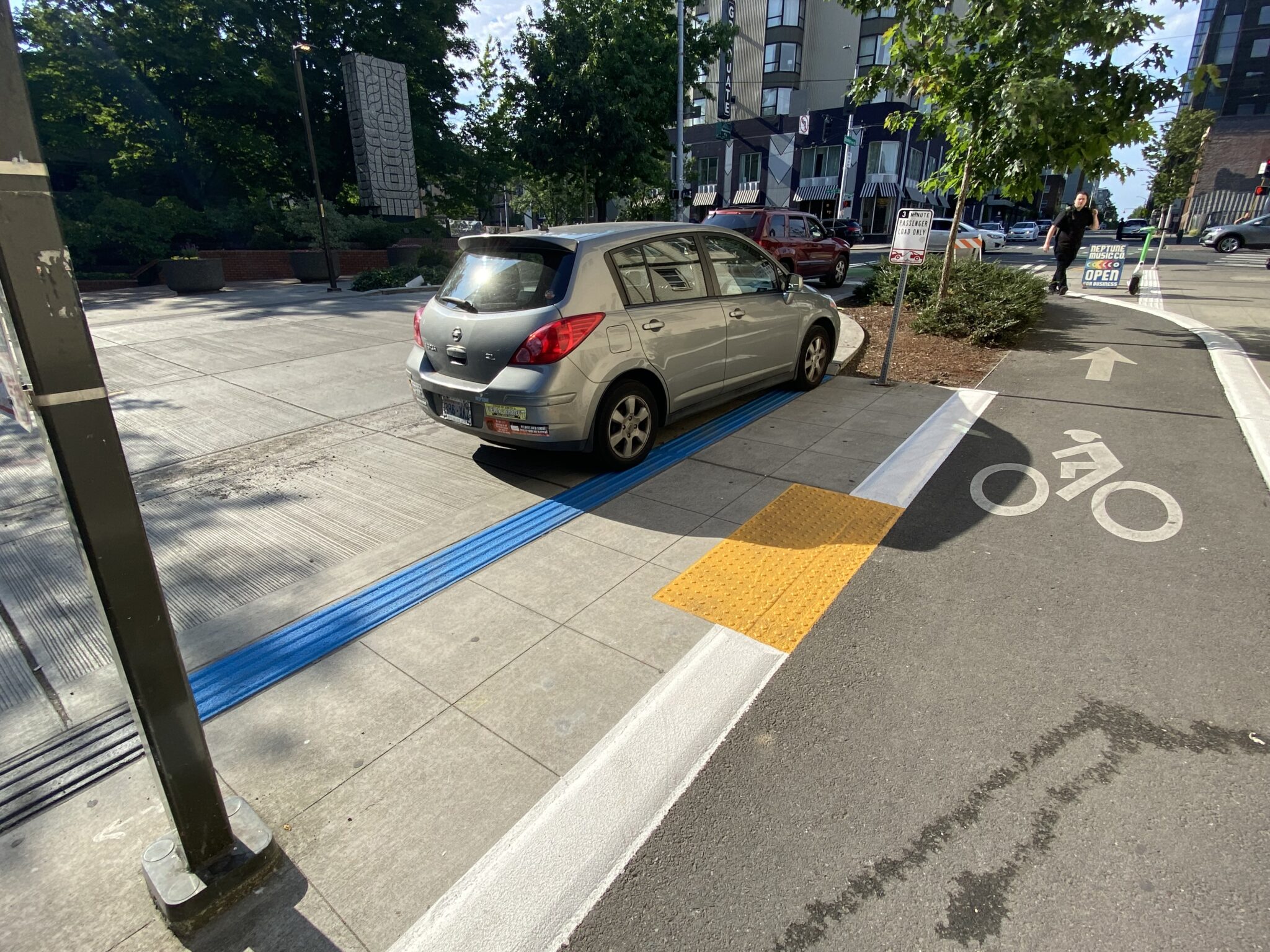
Here are the new tactile elements we recently installed in the University District.
U District – Brooklyn Ave NE and NE 45th St

These raised tactile surfaces are a relatively new development, and they build on previous efforts we’ve undertaken in Seattle (read more in this previous blog post). We are currently working with local partners that support people with vision disabilities to request their feedback on these features. These organizations include the Lighthouse for the Blind, National Federation of the Blind, DeafBlind Service Center, and Washington State Department of Service for the Blind .
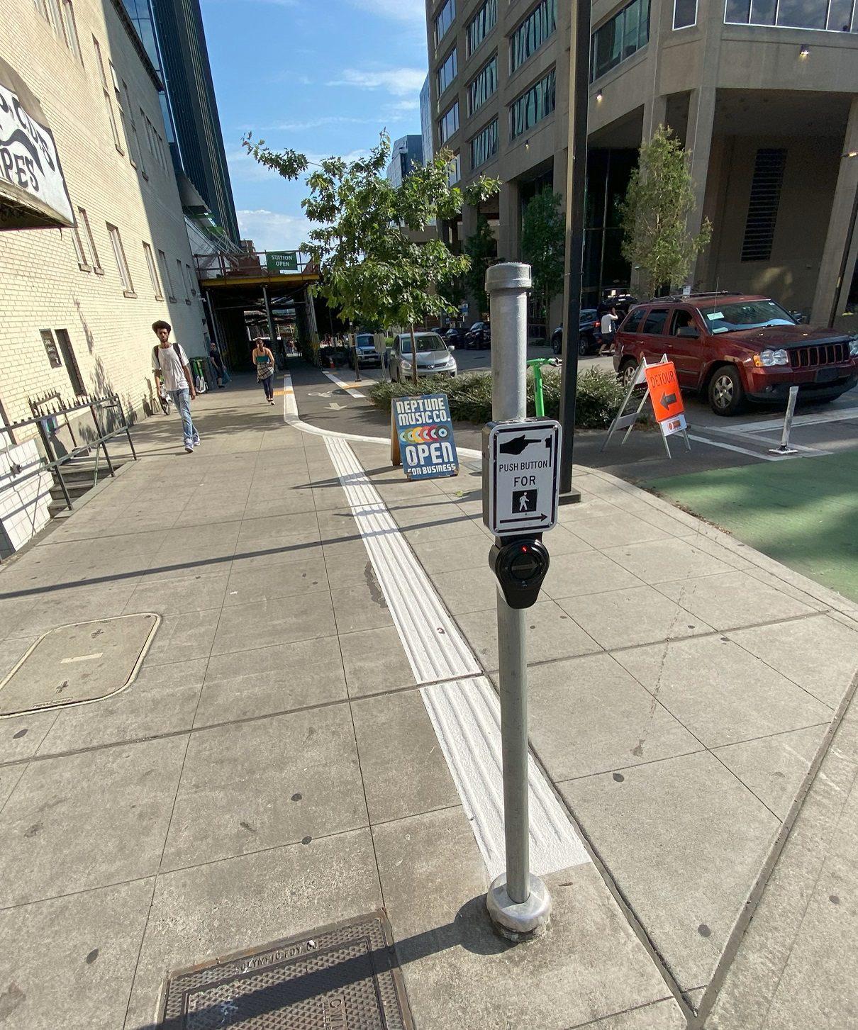
These raised tactile surfaces are a relatively new development with no formal requirements in the United States, and they build on previous efforts we’ve undertaken in Seattle (read more in this previous blog post). We are currently working with local partners that support people with vision disabilities to request their feedback on these features. These organizations include the Lighthouse for the Blind, National Federation of the Blind, DeafBlind Service Center, and Washington State Department of Service for the Blind.
Timeline of our pilot project activities in 2024:

2024 timeline:
- May: SDOT coordination and concurrence, site planning, develop communications plan
- June: Finalize plan and participants for testing (Pedestrian Access Advisory Committee, bike/pedestrian boards), begin data collection of existing Tactile Walking Surface Indicator applications
- July: Installation of pilot materials, continue data collection
- August: Installation and testing, develop data collection report
- September: Complete testing, develop summary of findings and observations
- October: Additional feedback, analysis, and reporting
While the current pilot will focus on the three types of treatments listed above, future pilot projects could include bike and/or transit elements to further support non-visual navigation for Blind, DeafBlind, and people with low vision. We intend to use feedback from a variety of volunteer participants to formulate a toolbox and set of guidelines that can be applied to future SDOT projects as well as Americans with Disabilities Act (ADA) accommodation requests received by our ADA Program. Participation in the pilot study will consist of visiting at least one of the test sites with SDOT staff, participating in different maneuvers and scenarios, and providing feedback via a questionnaire.
If you’re interested in knowing more about this project or other ADA projects and accessibility treatments in the public right-of-way or want to get involved and join our Pedestrian Access Advisory Committee, please contact us at DOT_ADAProgram@seattle.gov for more information and to be included on the email distribution list. You can also visit our website or check out this previous blog post about the various ways we’re working to make Seattle more accessible for everyone.


